How Nigeria’s flood warnings work, and how to read the next alert
A NIHSA alert put parts of 15 states at high flood risk last week. Here is the science behind the forecasts and what each warning asks you to do.
By John Christian Mmaduabuchi, Chief Editor
· · 3 min read
- NIHSA's newest advisory covers 17 states, eight at high risk, from 28 September to 4 October
- River floods often follow rain that fell far upstream days earlier
- Act early: move people, livestock and valuables to higher ground
The gist in 30 seconds
- NIHSA's newest advisory covers 17 states, eight at high risk, from 28 September to 4 October
- River floods often follow rain that fell far upstream days earlier
- Act early: move people, livestock and valuables to higher ground
Updated 18:23 WAT, 30 Sep 2026: NIHSA has issued a new flood advisory covering 17 states from 28 September to 4 October, with eight at high risk.
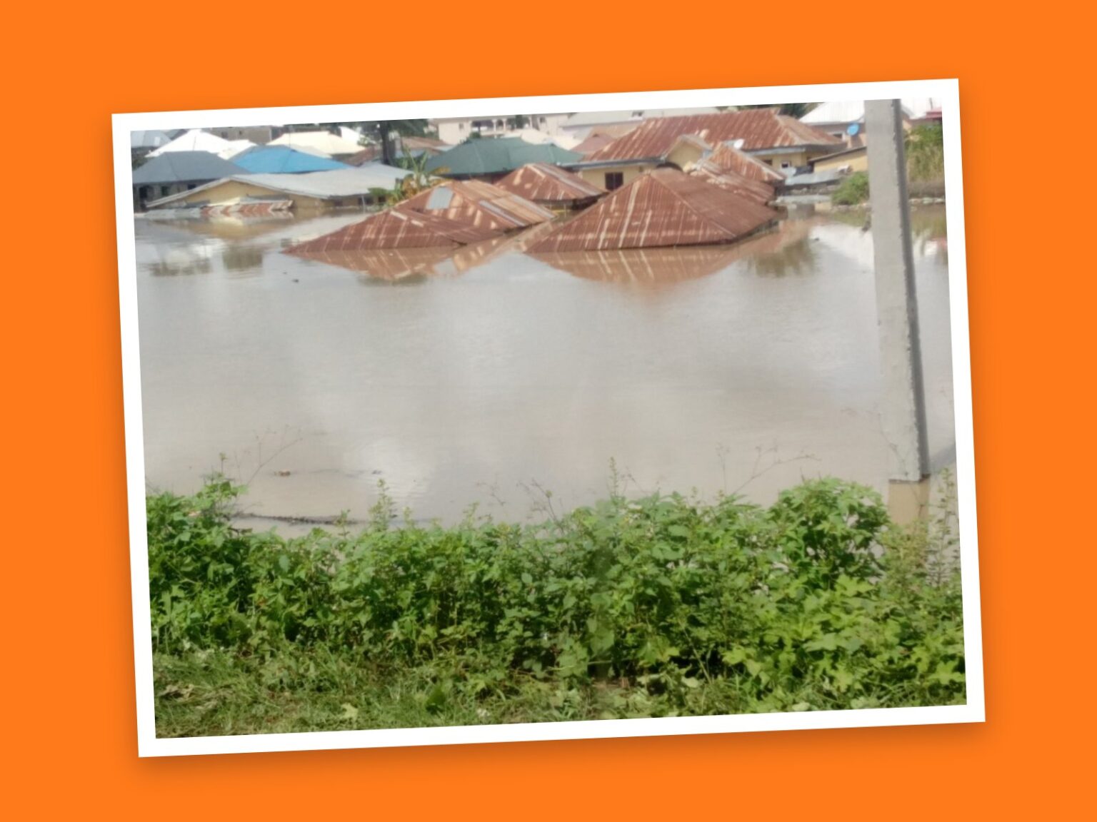
Last week the flood warnings came thick and fast. The Nigeria Hydrological Services Agency (NIHSA) issued an alert, coded NFA-2026-262, placing parts of 15 states at high risk of flooding between 19 and 25 September. The National Emergency Management Agency (NEMA) responded by putting its emergency teams on red alert.
The states named were Imo, Cross River, Ebonyi, Benue, Anambra, Akwa Ibom, Lagos, Rivers, Edo, Kogi, Taraba, Delta, Bayelsa, Enugu and Abia. In Cross River alone, NIHSA listed 2,471 communities, 703 schools and 344 health facilities in at-risk areas.
A newer alert is now in force. NIHSA’s latest advisory, covering 28 September to 4 October, names 17 states, The Sun and The Whistler reported. Eight are rated high risk: Imo, Cross River, Ebonyi, Benue, Anambra, Kogi, Rivers and Enugu, according to The Whistler, which said about 6,800 communities, more than 5,800 schools and more than 2,000 health facilities lie in at-risk areas. Edo, Delta, Osun, Ondo, Ogun and Lagos are among the states rated medium to low risk.
To understand the warnings, it helps to know that hydrologists broadly separate flash floods, when intense rain overwhelms drains and streets within hours, from river (riverine) floods, when rivers rise and spill over their banks. River floods can arrive days after the rain that caused them, because water from a wide catchment, sometimes hundreds of kilometres upstream, takes time to travel down the channel. That delay is what makes forecasting possible.
How the forecasts are made
The long-range view is NIHSA’s Annual Flood Outlook. The 2026 edition, released in April, placed 14,118 communities in 266 local government areas across 33 states and the FCT in high-risk zones. NIHSA says this year’s modelling was upgraded to a hybrid system that integrates artificial intelligence, alongside a flood dashboard for decision-makers.
During the rainy season the focus shifts to short windows, such as last week’s seven-day alert. Gauging stations record river levels, and forecasters combine those readings with rainfall forecasts and models to predict where water will rise next. Last week’s alert flagged stations including Obubra, Itigidi and Epento in Cross River State for close monitoring.
How to use an alert
- Check whether your state, local government and community are listed, and note the dates covered.
- If you live near a river or on low ground, act early. NIHSA advises moving “people, livestock and valuables to safer, higher ground” where necessary.
- Never walk or drive through floodwater, across submerged bridges or into fast-moving water.
- Clear blocked drains around your home and store safe drinking water.
- Follow NIHSA, NEMA and your state emergency management agency for updates.
What next: The current advisory runs until Sunday, 4 October. Check whether your state and community are listed, and look out for fresh advisories from NIHSA and NEMA as the rainy season continues.
Sources
We checked this story against these sources. How we check
- The Guardian Nigeria: NiHSA flags high flood-risk areas in C’River, Imo, Ebonyi, 12 others
- Vanguard: NEMA orders emergency teams on red alert as flood threatens 15 states
- Vanguard: Flood to hit Lagos, Bayelsa, Delta, Adamawa, 29 other states - FG
- The Eagle Online: Flood Alert: FG lists 266 LGAs in 33 states, FCT at risk
- The Sun: NIHSA raises flood alarm in 17 states (29 Sep 2026)
- The Whistler: 6,800 Communities At Risk As NIHSA Warns 17 States Of Flooding (29 Sep 2026)
How does this story make you feel?

John Christian Mmaduabuchi is a Nigerian filmmaker, creative director, and media professional with extensive experience in digital storytelling, visual journalism, and contemporary media. His Journalism interests span Nigerian and African current affairs, entertainment, culture, technology, lifestyle, media, and the people shaping public conversation. With a background in film direction and documentary production, he brings a strong visual and narrative perspective to editorial work, with particular attention to context, clarity, and compelling storytelling. John is also a creative entrepreneur focused on storytelling, entertainment, culture, and digital content. His professional experience across directing, cinematography, editing, media strategy, and emerging AI technologies gives him a broad understanding of how stories are created, distributed, and consumed in the digital age. At GistMatrix, John contributes to the development and presentation of timely, engaging, and relevant stories for a contemporary audience. His approach to editorial work is grounded in accuracy, context, responsible storytelling, and a commitment to covering stories that matter.